


Google Maps adds COVID-19 info layer on mobile
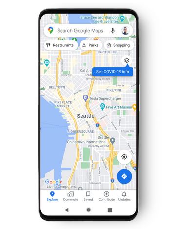
Google Maps has started rolling out a new COVID-19 data overlay for Android and iOS. The new layer shows "critical information about COVID-19 cases in an area" so that you can make "more informed decisions about where to go and what to do."
To access the feature, tap on the layers button on the top right-hand corner of the screen and select "COVID-19 info." The app will then show a seven-day average of new COVID-19 cases per 100,000 people for the part of the map you're looking at. A label will show if cases are trending up or down, with colour coding to help you distinguish between the density of new cases in an area.
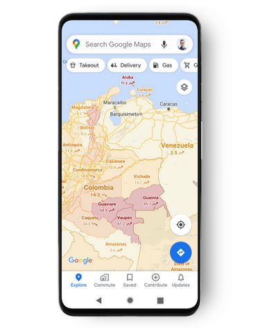
Google Maps will show trending case data at the country level for all 220 countries and territories that the app supports, along with state or province, county, and city-level data where available.
Google used data from authoritative sources like Johns Hopkins, the New York Times, and Wikipedia, which get their information from public health organizations like the World Health Organization, government health ministries, along with state and local health agencies and hospitals.
 Nicole Batac
Reader Comments